
Sustained, Co-Ordinated Processing of Environmental Satellite Data for Climate Monitoring (SCOPE-CM):
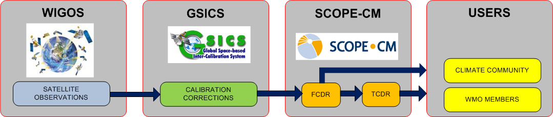
The Sustained and Coordinated Processing of Environmental Satellite Data for Climate Monitoring (SCOPE-CM) group’s primary goal is to ensure international coordination and production of satellite-derived Climate Data Records (CDRs) in response to Global Climate Observing System (Global Climate Observing System | World Meteorological Organization (wmo.int)) requirements. CDRs are consistently-processed time series of uncertainty-quantified data, located in time and space, of sufficient length and quality to be useful for climate science or applications. Besides revealing patterns and relationships in a changing climate, CDRs strongly support climate modeling and process studies, and are often combined with social science and socio-economic data in government, academia and business.
SCOPE-CM was chartered by the World Meteorological Organization in 2008, and works closely with the CEOS-CGMS Joint Working Group on Climate (WGClimate). Specifically, the latter group maintains an international inventory of CDRs with which it identifies gaps when compared to GCOS requirements. SCOPE-CM works with space and meteorological agencies to fill these gaps, in particular by facilitating multi-agency cooperation in areas such as product development and maturation, data sharing and stewardship. SCOPE-CM also works with the agencies to ensure coordinated and sustained production of mature CDRs compliant with GCOS guidelines and best practices.
Read more about SCOPE-CM at www.scope-cm.org.